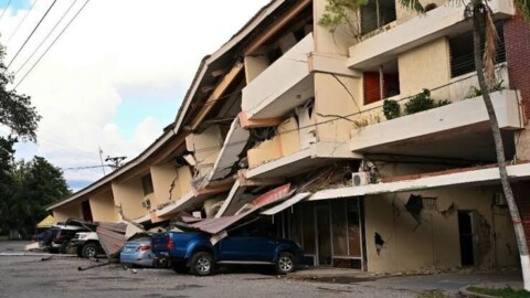
A magnitude 6,6 earthquake struck off the coast of New Caledonia overnight Friday to Saturday , according to data from the United States Geological Survey. The epicenter was located approximately 80 kilometers east-northeast of Tadine, on the island of Maré, at an estimated depth of 10 kilometers. The USGS initially assessed the quake at a magnitude of 7 before revising its measurements, a common procedure as more seismic data becomes available.
At this stage, no reports of significant damage or casualties have been announced. The U.S. tsunami warning system has not indicated a threat to Hawaii, Guam, the Northern Mariana Islands, or American Samoa. The relatively remote location of these islands from major urban centers reduces the risk of major impacts, although a tremor of this magnitude could still be clearly felt in the archipelago. The USGS has classified the event as a gray alert in its PAGER system, which corresponds to the absence of a significant estimate of human or economic losses at this stage.
A region accustomed to high seismic activity
New Caledonia is located in a tectonically active area of the Pacific Ocean, near the New Hebrides arc and the boundary between the Australian and Pacific plates. Earthquakes are frequent, particularly in the eastern part of the territory, towards the Loyalty Islands and Vanuatu. This activity results from the subduction of the Australian plate beneath the Pacific plate, a mechanism capable of producing powerful tremors and, in some cases, tsunamis. However, not all underwater earthquakes trigger dangerous waves: their depth, their mechanism, and the actual displacement of the ocean floor are determining factors.
Data released in the first few hours following an earthquake remains provisional and may still be adjusted. The USGS itself specifies that the magnitude, depth, and location of an event are regularly revised after analysis from new seismic stations. Local authorities and specialized centers therefore continue to monitor the area, particularly in the event of aftershocks. For now, this magnitude 6,6 earthquake appears primarily as another significant event in a region where tectonic activity is a constant natural hazard.